
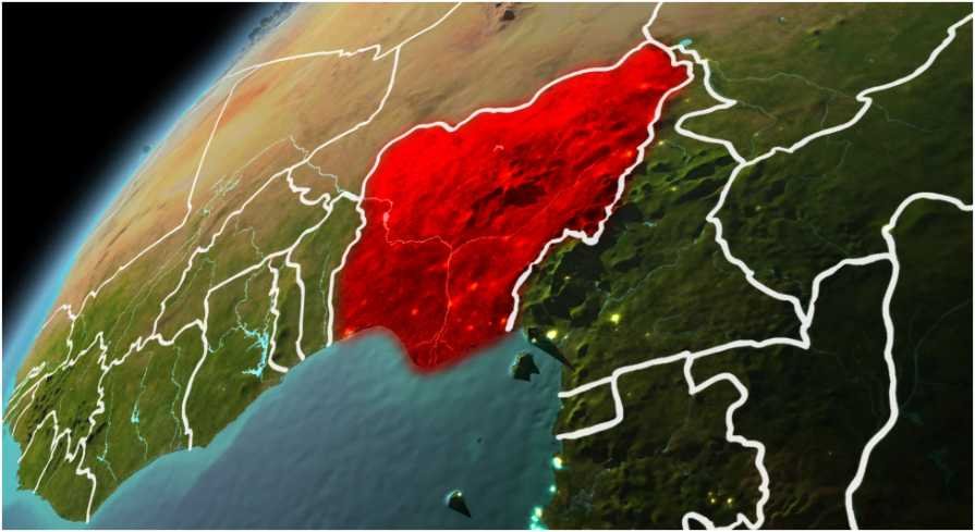
If you are searching for rivers in Nigeria and their location, the fastest way to understand the map is to start with two names: Niger and Benue. These two rivers shape the country’s drainage, travel routes, farming zones, flood patterns, and even major settlement areas.
I find Nigeria’s river map easier to read when I divide it into three groups. The first is the Niger-Benue system. The second is the coastal river network. The third is the Chad Basin system in the north. Once you see that pattern, the country’s rivers stop looking scattered.
Why Nigeria’s Rivers Are Easy to Understand Once You See the Pattern
Nigeria does not have just one river story. It has several water systems that move in different directions.
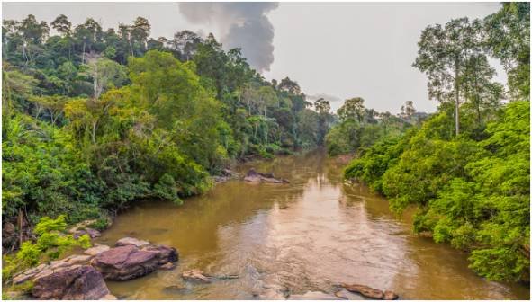
The Niger-Benue system dominates the central and southern part of the country. It drains a large share of Nigeria before spreading into the Niger Delta and reaching the Atlantic Ocean. The coastal rivers flow more directly toward the Gulf of Guinea and nearby lagoons. The Chad Basin rivers move northward toward Lake Chad instead of the Atlantic.
That difference matters. A river in Lagos or Cross River State does not behave like a river in Jigawa or Borno. One supports coastal wetlands and ports. Another supports dryland farming, grazing routes, and seasonal floodplains.
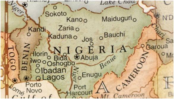
My quick map trick is simple: picture the Niger and Benue as a large Y-shape. The Niger comes from the northwest and bends south. The Benue comes from the east. They meet at Lokoja in Kogi State. From there, the combined flow moves toward the Niger Delta.
The Two Major Rivers in Nigeria
The two most important rivers in Nigeria are the Niger River and the Benue River. They form the main inland water network and create the famous confluence at Lokoja.
Niger River Location
The Niger River enters Nigeria from the western side, near the Benin and Niger border region. It flows through or influences states such as Kebbi, Niger, Kwara, Kogi, Edo, Anambra, and Delta.
Its journey inside Nigeria is not just a line on a map. It connects farming areas, transport routes, fishing communities, and floodplains. After meeting the Benue River at Lokoja, it continues southward into the Niger Delta region before emptying into the Atlantic Ocean.
For travelers, Lokoja is the easiest place to understand the Niger visually. The city is known for the confluence because the Niger and Benue meet there in a dramatic Y-shaped formation.
Benue River Location
The Benue River enters Nigeria from Cameroon in the east. It flows westward through Adamawa, Taraba, Benue, and Nasarawa before meeting the Niger River at Lokoja in Kogi State.
The Benue is the Niger River’s largest tributary. Its location makes it vital to central and eastern Nigeria. It supports agriculture, fishing, settlements, and inland movement across several states.
The Benue also explains why Lokoja matters so much. Without this meeting point, Nigeria’s central river map would look completely different.
Major Tributaries of the Niger-Benue System
The Niger and Benue are the headline rivers, but their tributaries complete the picture. These rivers feed the larger system and affect local communities across northern, central, and southeastern Nigeria.
Sokoto River
The Sokoto River is located in northwestern Nigeria. It passes through areas connected with Katsina, Zamfara, and Sokoto states before joining the Niger River system.
Its location makes it important in a drier part of Nigeria. Rivers in this zone often support irrigation, livestock, and seasonal farming. That gives the Sokoto River a practical role beyond geography.
Kaduna River
The Kaduna River is located in north-central Nigeria. It flows through Kaduna State and joins the Niger River in Niger State.
This river is important because it runs through one of Nigeria’s major inland regions. It supports settlements, agriculture, and water supply needs. It also shows how the Niger River collects water from multiple parts of the country before flowing south.
Gongola River
The Gongola River is located in northeastern Nigeria. It flows through Bauchi, Gombe, and Adamawa states before feeding into the Benue River.
Its location places it between the drier northeast and the Benue drainage system. That makes it important for farming communities and seasonal water movement. The Gongola also helps explain how northeastern waters connect to the larger Niger-Benue network.
Katsina-Ala River
The Katsina-Ala River begins around the Cameroon border area and flows through Benue State. It eventually joins the Benue River.
This river is especially useful when studying central-eastern Nigeria. It connects borderland drainage with the Benue Valley. Its path also supports communities that rely on farming and fishing.
Anambra River
The Anambra River is located in south-central Nigeria. It flows through Enugu and Anambra states before emptying into the Niger River.
Its position makes it important to southeastern Nigeria’s inland water system. It also connects local communities to the wider Niger drainage network. For map readers, it is a helpful reminder that not every Niger tributary comes from the north.
Coastal Rivers in Nigeria and Their Location
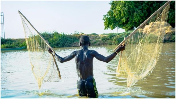
Coastal rivers flow directly toward the Atlantic Ocean or connected coastal water bodies. These rivers are shorter than the Niger, but they matter because they support wetlands, lagoons, fishing, and coastal settlement.
Cross River
The Cross River is located in southeastern Nigeria. It flows through Cross River State and Akwa Ibom State before entering the Gulf of Guinea.
Its location gives it strong ecological value. The surrounding region includes wetlands, forest zones, and coastal communities. It is one of Nigeria’s best-known rivers outside the Niger-Benue system.
Imo River
The Imo River is located in southeastern Nigeria. It flows through Imo, Abia, and Rivers states before reaching the Atlantic coastal system.
This river matters because it drains a populated part of southeastern Nigeria. It supports local communities and connects inland areas to the coastal environment.
Ogun River
The Ogun River is located in southwestern Nigeria. It flows through Oyo and Ogun states before emptying into the Lagos Lagoon.
Its location makes it important to the Lagos and Ogun region. For anyone studying urban geography, this river is worth noting because it connects inland southwestern Nigeria with the lagoon system around Lagos.
Osun River
The Osun River is also located in southwestern Nigeria. It flows through Osun, Oyo, and Ogun states before joining the Atlantic coastal drainage network.
The Osun River is known for both geography and culture. Its route supports communities across the southwest, while its name is also connected to important Yoruba cultural heritage.
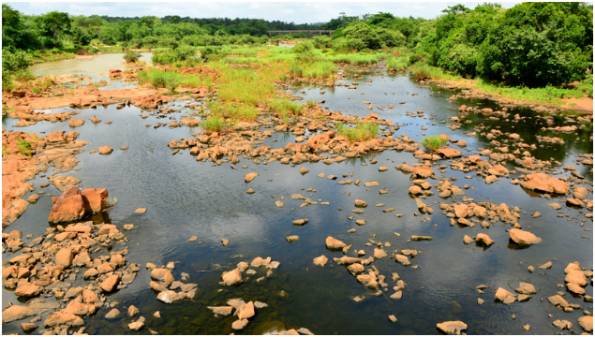
Chad Basin Rivers in Nigeria
Not all Nigerian rivers flow south. Some rivers in the north and northeast move toward the Lake Chad area. This creates a separate drainage pattern from the Niger-Benue and coastal systems.
Hadejia River
The Hadejia River is located in northern Nigeria. It flows through Kano and Jigawa states toward the Lake Chad Basin.
This river supports dryland farming and wetlands in northern Nigeria. Its location matters because northern river systems often depend heavily on seasonal rainfall and flood patterns.
Yobe River
The Yobe River is located in far northeastern Nigeria. It forms part of the border between Nigeria and Niger around Yobe and Borno states before moving toward Lake Chad.
The Yobe River is important because it sits in a fragile water region. Lake Chad and its connected river systems support farming, fishing, grazing, and settlement across multiple countries.
Why These Rivers Matter Beyond Geography
When I look at rivers in Nigeria and their location, I do not see only names to memorize. I see routes that explain trade, food, flooding, settlement, and travel.
The Niger and Benue create Nigeria’s main inland water backbone. Their confluence at Lokoja is more than a landmark. It is a geographic clue that explains how water from western, central, and eastern Nigeria joins before moving south.
Coastal rivers tell a different story. They show how southern Nigeria connects to lagoons, creeks, wetlands, and the Atlantic. These rivers matter for fishing, local transport, biodiversity, and coastal economies.
The Chad Basin rivers add another layer. They show how northern Nigeria connects to a larger Sahelian water system. That region faces different water pressures than the south, so the rivers there carry major importance for farming and survival.
A useful example is this: if you are planning a geography lesson, start with Lokoja. Then move outward. Trace the Niger northwest, the Benue east, the coastal rivers south, and the Chad Basin rivers north. That single exercise gives you a working mental map of Nigeria’s water systems.
FAQs About Rivers in Nigeria and Their Location
1. What are the two major rivers in Nigeria?
The two major rivers in Nigeria are the Niger River and the Benue River.
2. Where do the Niger and Benue rivers meet?
The Niger and Benue rivers meet at Lokoja in Kogi State.
3. Which rivers in Nigeria flow into the Atlantic Ocean?
The Niger, Cross, Imo, Ogun, and Osun rivers connect directly or indirectly to the Atlantic coastal system.
4. What are the main rivers in Nigeria and their location?
The main rivers include the Niger in western-central-southern Nigeria, Benue in eastern-central Nigeria, Cross in the southeast, Ogun in the southwest, and Yobe in the northeast.
Final Take: The River Map Has Receipts
The smartest way to remember rivers in Nigeria and their location is to stop memorizing a random list. Group them by direction and drainage.
The Niger and Benue form the main Y-shaped system. Coastal rivers move toward the Atlantic. Chad Basin rivers move northward. That simple pattern makes Nigeria’s river geography much easier to understand.
My next-step tip is simple: open a blank map of Nigeria and mark Lokoja first. Once you place the confluence, the rest of the river network starts behaving like it has manners.